Sweeney Ridge: Skyline College to San Bruno
- Routes to the trail:
- SamTrans 121
- SamTrans 141
- Stop: Skyline College Transit Center
- Travel time out: 20min
- Routes back from the trail:
- SamTrans 141
- Stop: Riverside Dr & Sneath Ln
- Travel time back: 12min
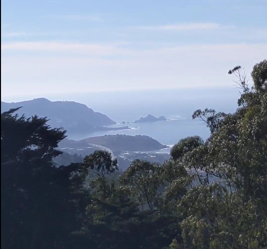
Sweeney Ridge hosts a former Nike missle site, and the site where the Portolá expedition first spotted the San Francisco Bay upon coming north up from where they’d landed their boat.
Today, it’s a part of the Golden Gate National Recreation Area. On the peninsula, the advantage this brings is connectivity: the GGNRA is a distinctly recreation-first organization, unlike Midpen (whose primary mission is natural preservation, with recreation second) and the SF Public Utilities Commission (whose primary mission is water delivery, with recreation waaaay down the list) that own a lot of the land in the area. The Ridge is therefore connected down into Pacifica in two locations on the west side, up into Skyline College on the north side, and out into San Bruno on the east side.
The most basic transit-accessible hike at Sweeney Ridge would be to hike out from the Skyline College trailhead, linked above, to the Nike missle site or the Portolá expedition memorial. This 4-mile out and back hike takes you uphill on a great butterfly spotting trail and through some shrubby forest before arriving at the top of the ridge and the missle site. If you want to go further, continue along the Sweeney Ridge Trail, which becomes paved at this point; the expedition memorial is just past the restrooms where the paved road turns downhill.
For a 4.8mi hike, turn down the paved road to be greeted with reservoir views. The road continues for around a mile and a half before the lower entrance gate, at which point you can continue on city streets to the bus stop at Riverside Dr & Sneath Ln.
For the maximum hike (+2.4mi), instead of turning downhill, continue along Sweeney Ridge and hike a loop of the rare freshwater wetland (dry at time of my visit) Sweeney Meadow and Sweeney Horse Trail.