San Bruno Mountain State & County Park
Just outside San Francisco, head up and over the chapparal slopes of San Bruno Mountain and enjoy 360° views of San Francisco, South City, and beyond.
- 6.2miDistance
- hardDifficulty
- All weekTransit service
- 1Trailheads
From Daly City or Balboa Park BART
To the trail
Travel time: 8-12min
Routes
Stops
- Bellevue Ave & Pope St — SamTrans 121
- Chicago Way & Cordova Ave — Muni 43
Return trip
Travel time: 14min to 4th & King
Routes
Stops
Travel times are estimates from Daly City or Balboa Park BART.
San Bruno Mountain is peculiar. In many ways, it has defined how San Francisco meets its southern neighbors: its slopes first forced the early railroads of the area the long way around to the west, the path of today's BART trains; later, it forced the Southern Pacific Railroad to build a series of expensive tunnels to speed up trains on the slow approach into the city, the path of today's Caltrain. For commuters on 101, rounding the mountain's eastern flank defines the transition between the sprawling office parks of the suburbs and the outer reaches of San Francisco.
However, despite its outsized role in defining what is and is not San Francisco, it's seldom thought of as more than one of the many nearly-anonymous ridges visible from the surrounding area. The main section of today's park was owned as late as the 1970s by the developers of the Crocker-Amazon neighborhood, planned for yet more residential sprawl.
It's the buses of those Crocker and Crocker-Amazon neighborhoods that let us get to the north side of the park today. The route indicated here starts at a small neighborhood entrance with a steep but short section of trail; the Crocker Gate trailhead (accessible only via SamTrans 121) offers a nice shallow entrance to the park if preferred. It's remarkable how immediate the feeling of being in a developed area drops away, with views behind of the ridgetop eucalyptus grove and views in front of the main body of San Bruno Mountain.
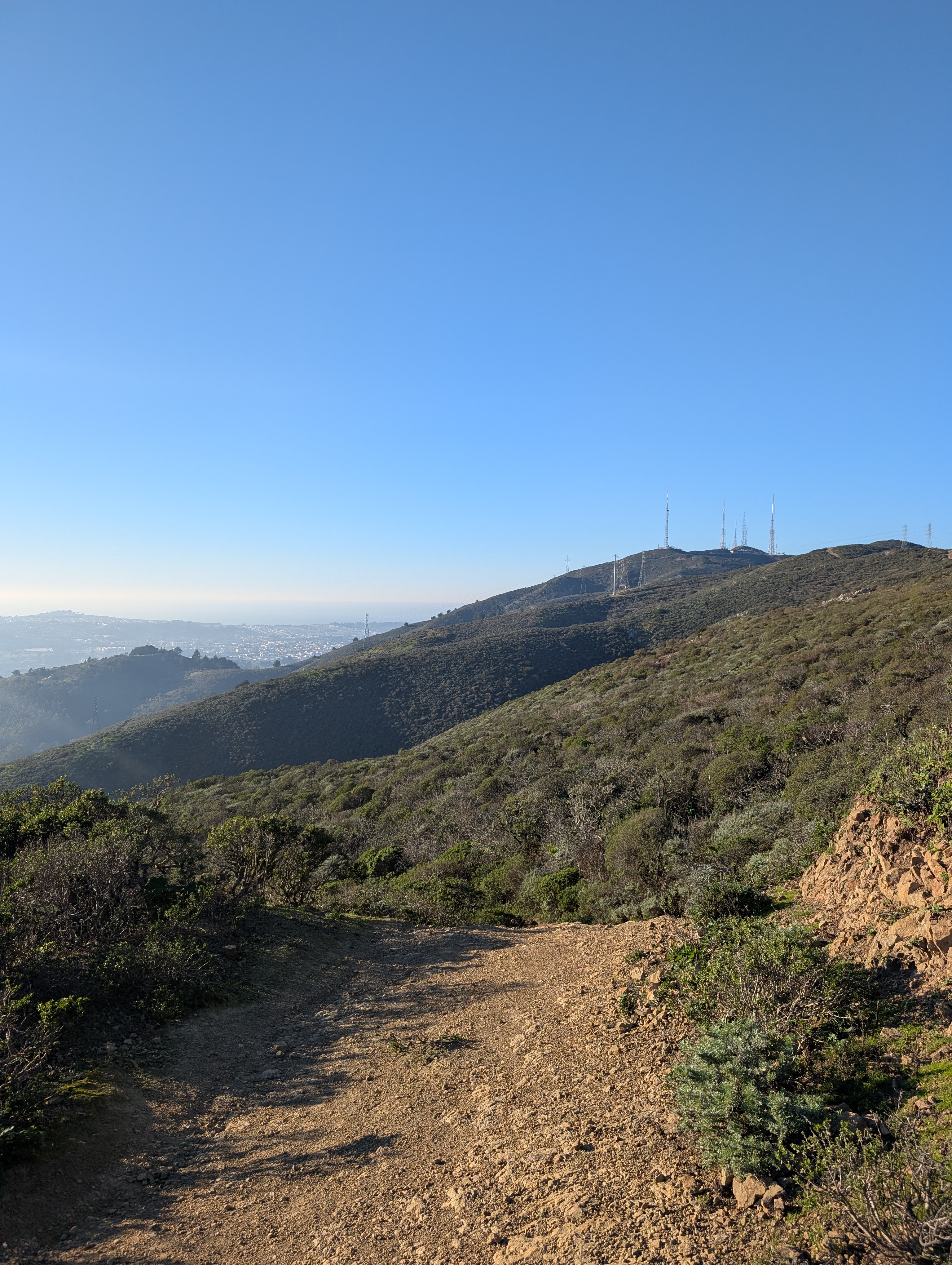
The trail slopes gently down to the Day Use Area, where restrooms are available. An underpass of Guadalupe Canyon Parkway takes you to the Summit Loop Trail, a steady but well-graded uphill. Take in the ever-changing views of San Francisco and the Marin Headlands behind you until reaching the Ridge Trail. The Ridge Trail quickly merges with a gravel maintenance road, providing a wide and well-maintained route along the ridgeline. Keep an eye out for raptors above and peninsula views in front.
The coastal scrub along the northern face of the mountain is the largest remaining area of the local Northern (Franciscan) Coastal Scrub that once covered the peninsula and San Francisco, and is the home to several now-rare species like San Bruno Mountain manzanita.
Once on the ridge, keep an eye out on the right side for the unnamed trail down to South San Francisco, marked only with a sign labeled Fire Rd. Despite the lack of name, this is an official trail. Sections are quite steep, and be prepared for occasional areas of loose surface materials. Continue downhill toward the neighborhood until you reach Hillside Blvd.
At Hillside Blvd, turn right and cross at the signal to continue back uphill on Ridgeview Ct to the trailhead for Sign Hill. This hill is home to South City's famous Industrial City sign. Continue across Sign Hill until you reach Spruce Ave, the end of the trail for this hike. Take surface streets downhill to Caltrain (under 1mi on foot), or head down to Grand Ave & Spruce Ave to catch SamTrans 121 or SamTrans 141 buses back to BART.
San Bruno Mountain State & County Park map
The interactive route map and elevation profile require JavaScript. The GPX file remains available to download.
Loading route map…