Marin Headlands: Golden Gate Bridge to Marin City
See the Golden Gate Bridge and hike up into the Marin headlands for expansive views of San Francisco, the bridge, and the Bay.
- 5.7miDistance
- easyDifficulty
- All weekTransit service
- 1Trailheads
From Civic Center BART
To the trail
Travel time: 27min
Routes
Stops
Return trip
Travel time: 32min
Routes
Stops
Travel times are estimates from Civic Center BART.
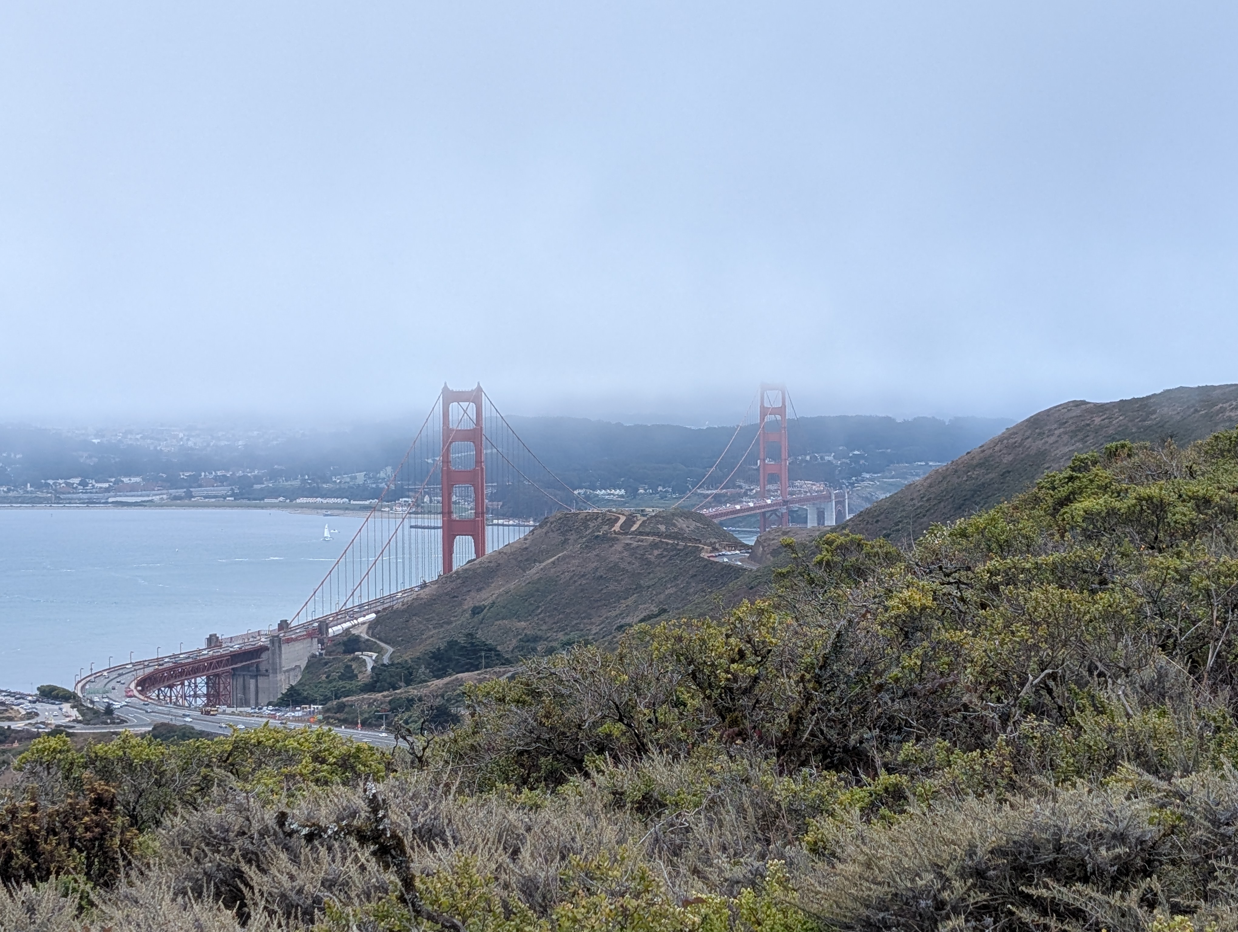
The Golden Gate Bridge is a must-see for every visitor to San Francisco, and for good reason. The bridge itself is architecturally stunning, and the landing is no less spectacular in the steep, hilly terrain of the Marin Headlands. Hourly Golden Gate Transit buses stop just past the main Vista Point, where this hike begins. After taking in the views of the bridge from close up, pass underneath the bridge and through the final visitor parking lot to find the beginning of the SCA Trail. The trail cuts across Conzelman Road, where hikers can head up towards Hawk Hill, and the trail gets significantly less busy after this crossing and up the ridge. Enjoy wildflowers, and views of the bridge getting hidden behind and reappearing in front of the hills each time the trail meanders.
The trail quickly winds its way up the side of Slackers Hill, one of the highest in the Headlands. As the trail approaches the saddle between Slackers Hill and Wolfback Ridge, the ambiance immediately changes. The highway below gives way to an expansive view of the backcountry wilderness of the inner headlands, with one final (and the most magnificent) view of the Golden Gate Bridge from the SCA Trail. From this junction, you can take a left to head up Slackers Hill for wide-open views of the bridge, the city, and the Bay, plus the headlands stretching out to the west. Or, continue the hike by turning right along the ridge, following the SCA Trail toward the edge of development in front of you.
Continue past the Morning Sun turnoff on Alta Trail, following Alta Trail as the suburbs reemerge to your right, eventually making your way back down to Marin City, where a strip mall awaits for snacks, and Golden Gate Transit 120 buses will pick you up for a trip back to San Francisco.
Marin Headlands: Golden Gate Bridge to Marin City map
The interactive route map and elevation profile require JavaScript. The GPX file remains available to download.
Loading route map…