National Park Week 2025: car-free Bay Area National Park trips
19 Apr 2025April 19th to 27th is National Park Week. To celebrate, here’s the best transit-accessible National Park properties in the Bay Area!
California’s early history as a state is in no small part the history of federal protection of our natural landscapes and resources. The state plays host to some of the country’s most impressive scenery across now nine National Parks and nearly countless more national National Parks properties. The Bay Area is home to many such impressive landscapes, and several of our best are accessible without ever geting into a car.
Muir Woods National Monument
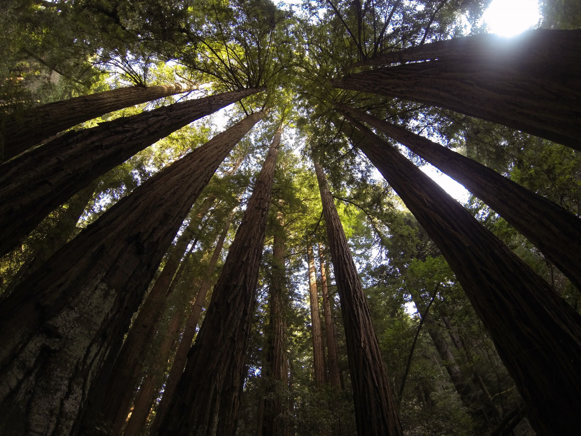
Old-growth forests are rare across the United States. These forests, untouched by loggers since before the United States existed, are perhaps grander than can be imagined. Thanks to the foresight of past generations, one such forest is preserved right in San Francisco’s backyard in Muir Woods, a national monument since 1908. The highlight of the forest is the old-growth Cathedral Grove, containing the park’s tallest and most graceful trees, but there’s not a bad trail in the park.
Today, during the peak spring-to-summer season, special Muir Woods shuttle buses run from the Larkspur Ferry Terminal directly into the heart of the park. Learn more about the shuttle with the Getting to Marin guide »
When the shuttle isn’t running, Marin Transit 61 buses can be taken to Pantoll Ranger Station, from which it is possible to hike down into Muir Woods. If you plan on doing this, a loop can be over 5 miles with over 1300 feet of elevation gain, so be prepared!
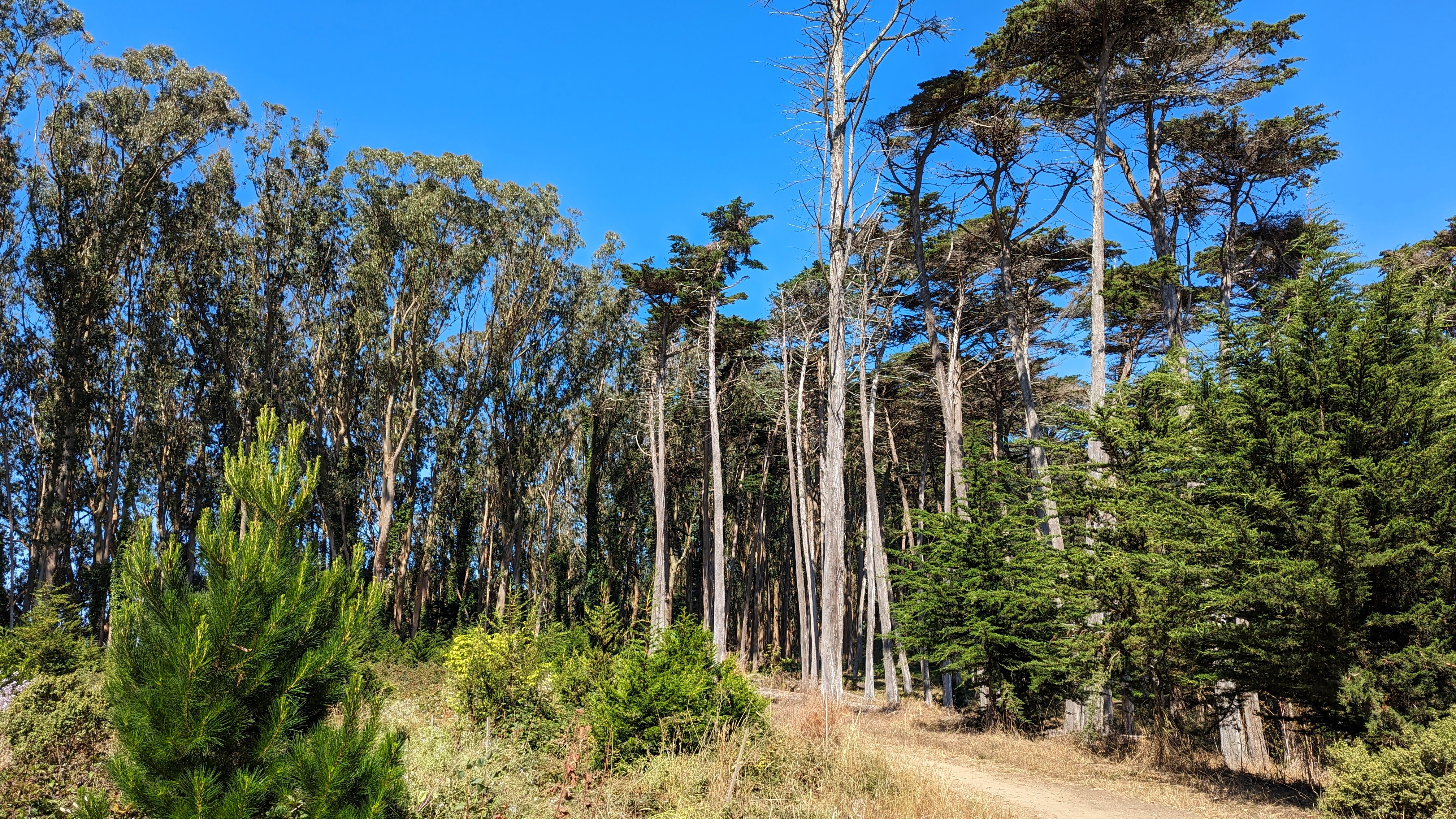
The Presidio
San Francisco’s sprawling historic fort at the Golden Gate Bridge is a popular destination for locals out for walks, runs, and rides, and the set-off point for innumerable tourists crossing the Golden Gate Bridge on foot or bicycle. Hosting the Walt Disney Family Museum, numerous historic fort sites open for visiting, and lots of spots perfect for picnicking, hanging out, and chatting, the uplands of the property also include miles of hiking trails through eucalyptus, cypress, and pine forest planted by the US Army for defensive and decorative purposes.
The best way to get to the Presidio is to pick where you want to go, and use a map app to route you there. Buses run along, into, and through, depending on where you’re going, so there’s always a way to get where you’re going. Learn how to get to the new Presidio Tunnel Tops park from the Parks Conservancy »
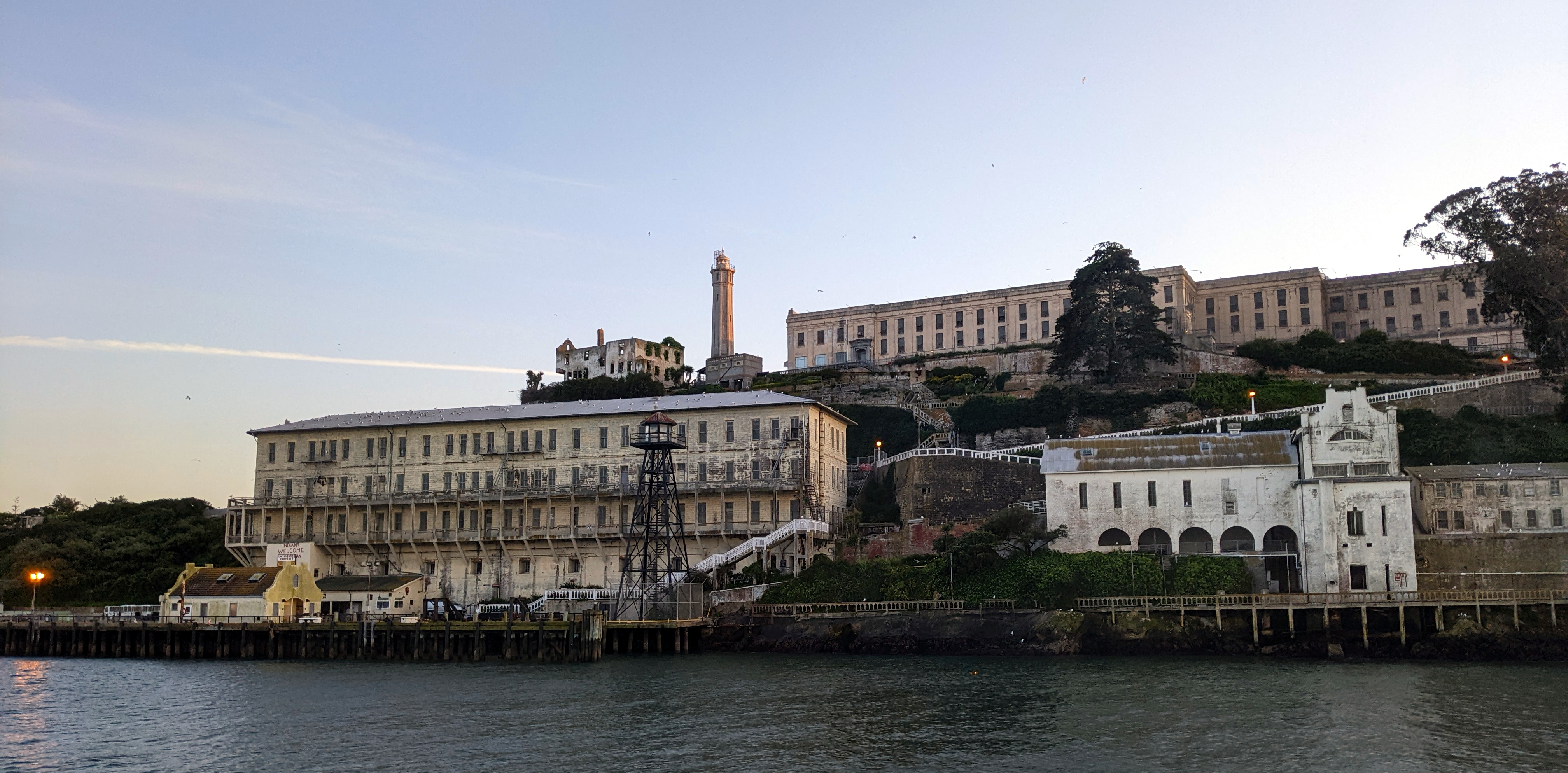
Alcatraz Island
The famous island in the middle of the San Francisco Bay is part of the sprawling Golden Gate National Recreation Area. The Golden Gate National Recreation Area encompasses huge swathes of protected coastal headlands in San Francisco, Marin, and San Mateo Counties, much of it former military sites containing old Nike missile silos, coastal defense batteries, and former forts.
Alcatraz is an absolute must-see on any San Francisco tourist’s itinerary, but many locals have only been either with visiting family, or as part of a childhood school trip. However, it’s an absolute must-see for good reason: the island is a cross-section of some of the most interesting periods in local history, having played critical roles in mid-19th century coastal defense, a maximum security prison home to Al Capone and Machine Gun Kelly, and the 1960s Indian civil rights movement. It’s also a great place to go to spot shorebirds.
Check out how to get to Alcatraz »
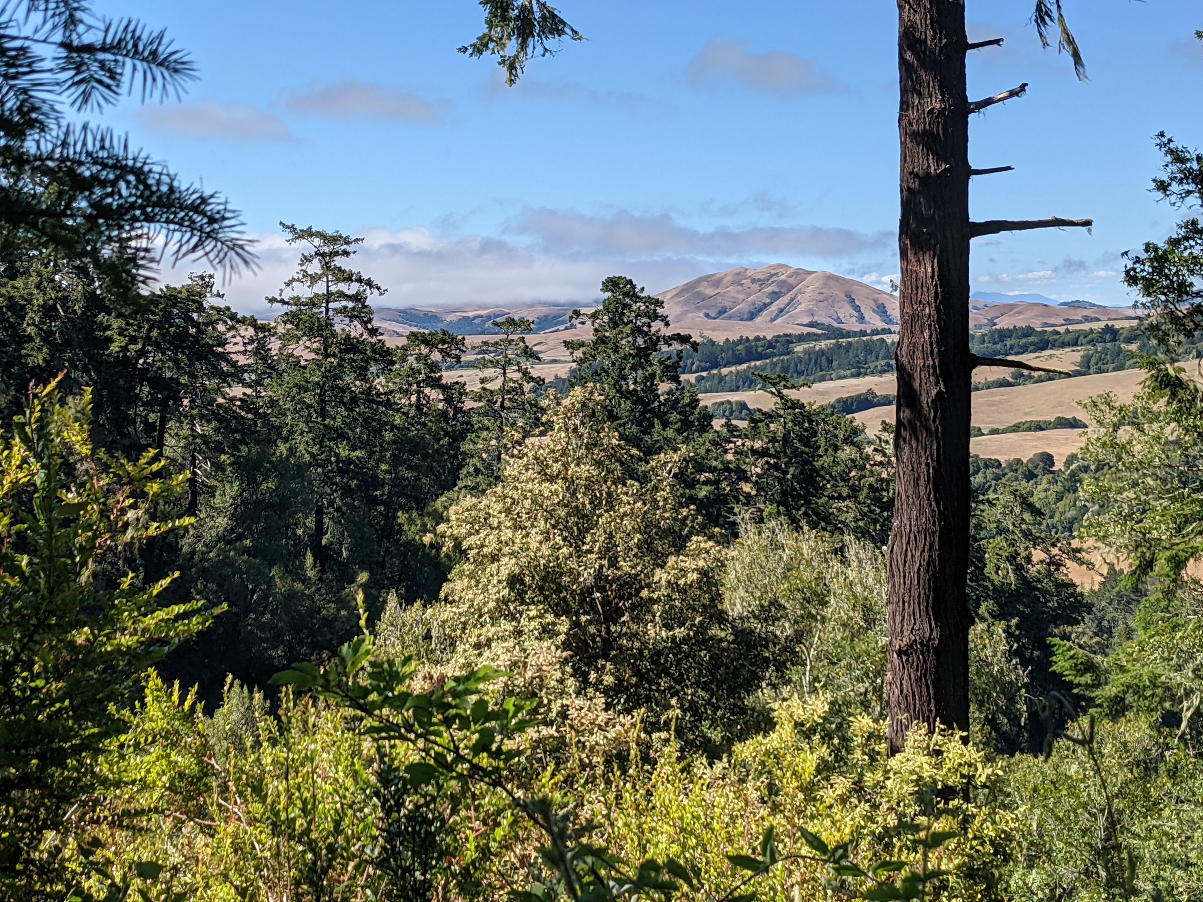
Point Reyes National Seashore
The windswept, rainswept, waveswept Point Reyes is perhaps the antithesis to San Francisco’s bustling urban spirit. It has every coastal ecosystem in the Bay Area in one preserve, with remote sandy beaches, grasslands, and forests of various kinds; valleys, fields, and ridges; flora, fauna, and a few tiny settlements.
Marin Transit 68 buses directly serve the Bear Valley Visitor Center, the main center for the park. Most of the most remote parts of the park are on the titular northwestern point, but the central portions of the park are still full of charm in their own right. It’s around 4.5 miles from the visitor center to the nearest beach, or 1.8 miles up to the top of nearby Mount Wittenburg from which one can see the point stretching into the ocean in the distance. Backpacking camps scattered around the backcountry also offer the opportunity to spend the night.
Learn more about Point Reyes National Seashore at the National Parks Service’s website »
…and all around the Golden Gate National Recreation Area!
The Golden Gate National Recreation Area covers a massive swath of the coastal counties of the Bay Area, extending from San Francisco north into Marin County and south nearly to Half Moon Bay. South of San Francisco, highlights like San Mateo County’s Sweeney Ridge and Mori Point are accessible via SamTrans buses.
The Golden Gate National Parks Conservancy has a guide to exploring different parts of the park by transit on their website that goes into depth on the parts accessible by bus, ferry, and train, and what to look for in each. Check out the Parks Conservancy guide here »
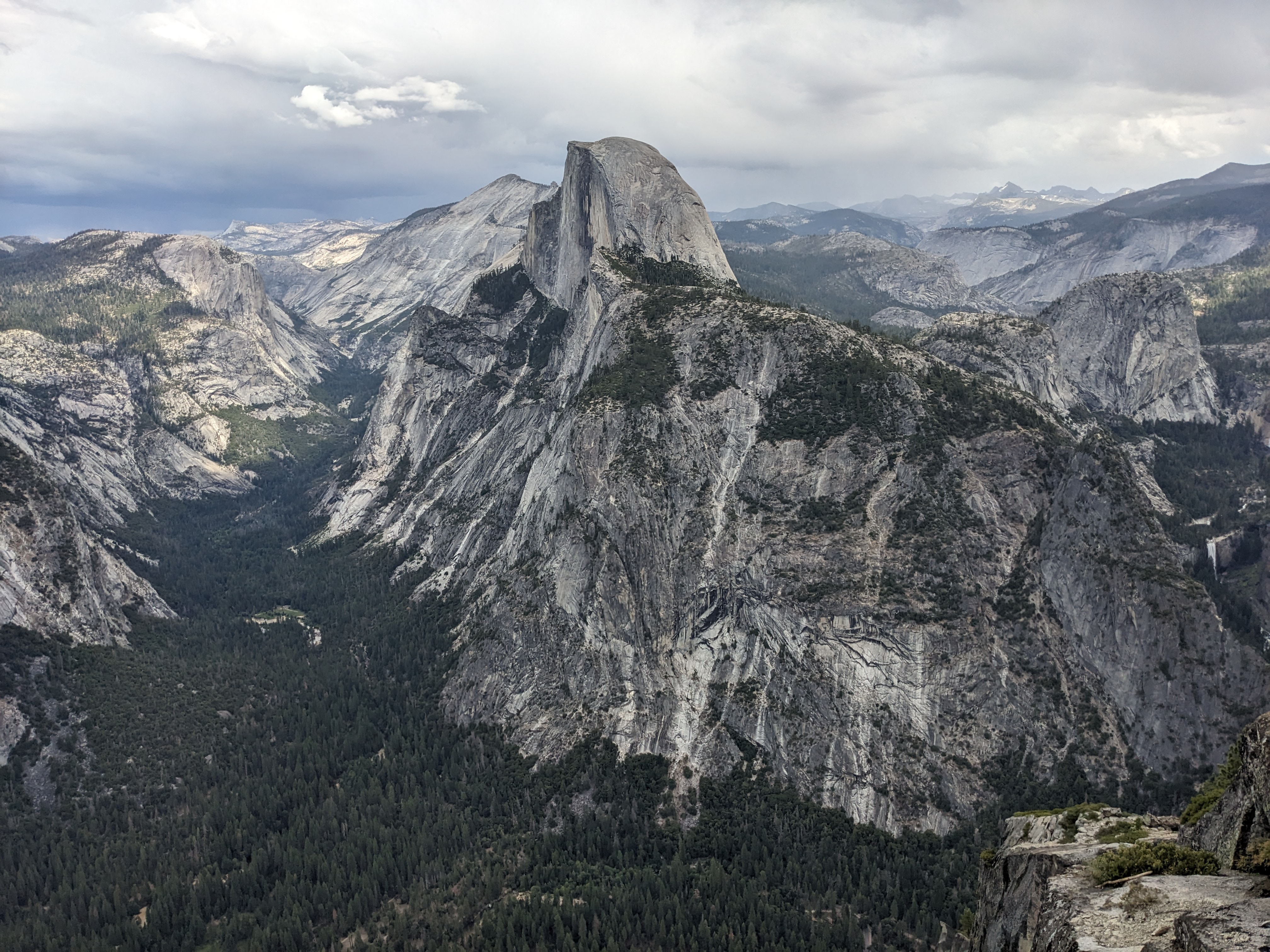
Yosemite National Park
Perhaps California’s most famous National Park, Yosemite is also the most easily accessed of the main National Parks in California. Known for its stunning granite cliffs and abundant waterfalls, the park’s main valley is the star of the show, and host to the YARTS bus connecting directly from Merced’s Amtrak station.
Yosemite merits as long as you can give it. The hiking opportunities are endless, from a 0.5mi loop hike to the base of Bridalveil Falls to the start of the 213mi Mt Whitney-bound John Muir Trail. It’s a photographer’s delight, a climber’s heaven.
Check out the Hiking by Transit guide to Yosemite National Park here »